Did someone say, White Chairs?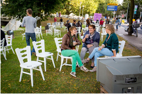
Showing posts with label public space. Show all posts
Showing posts with label public space. Show all posts
Thursday, January 10, 2013
Did someone say, White Chairs?


Friday, October 12, 2012
Do It Like The Dutch & Danes: Guide To Becoming A Bike Friendly Mecca

Thursday, November 17, 2011
More on public, private and social space. Andrew Curry reports from occupied London - Part II
Hopefully we have learned at least one hard lesson of life, and that is that a crisis is a terrible thing to waste. And here right before our eyes we have a case in point with the 
Monday, November 14, 2011
More on public, private and social space. Dispatch from Andrew Curry reporting from occupied London
We think quite a lot about space here at World Streets, from at least two perspectives. First and naturally enough given that the goal of 
Tuesday, August 2, 2011
Tragedy of the Commons: The car as enclosure
Chris Bradshaw, Canadian planner and new mobility innovator, takes us on a quick 
Tuesday, April 26, 2011
Moving Beyond the Automobile - Exit Parking
The tenth and final video in Streetfilms' Moving Beyond the Automobile series, looks into the necessary reasons and some of the techniques for parking reform. While the context is New York City, the lessons are universal. From doing away with mandatory parking minimums, to charging the right price for curbside parking, to converting
Monday, November 15, 2010
Fighting Traffic: The Dawn of the Motor Age in the American City
The author of this careful and quite extensive book review of the battle for America's streets 
Thursday, September 30, 2010
Parks vs. Parking: What do Indian cities need?
Chennai had prepared a plan some years ago for a multi-storey parking deck in T. Nagar where the Panagal Park now stands. T Nagar, once a quiet residential neighbourhood, is now the shopping centre for all of Chennai and has tremendous levels of congestion. The parking plan was called off due to protests by walkers and elderly citizens. I recently got the happy news that a revised plan to build an underground multi-storey parking facility below the Venkatanarayana Road playground also got struck down in the Madras High Court. The court reasoned that the city was lacking in open spaces – which are now considered an integral part of the constitutional right to life. The parcel under consideration is zoned as an open space and has been in use as a playground for more than 60 years. The court found that this activity cannot be disrupted for providing services to motorists who visit this central neighbourhood in the city for shopping.
--> Read on:Wednesday, September 29, 2010
Energy and Equity, Ivan Illich.
Earlier this week I proposed the idea of a group read and commentary on Illich's incisive and important 1974 book "Energy and Equity", but as I thrashed through my 
So here you have it. The whole thing. Print it out. Mark it up. Share your thoughts. Let me take a single phrase from the book to get the ball rolling: "Participatory democracy postulates low-energy technology. Only participatory democracy creates the conditions for rational technology." (And this almost two decades before the phrase "sustainable development" first appeared on the radar screen. So off we go with Illich as our guide!)
Tuesday, August 31, 2010
World Transport Policy & Practice - Vol. 16, No. 2
The Journal of World Transport Policy and Practice is the long standing idea and print 
Saturday, August 14, 2010

Monday, August 2, 2010
Honk! "Straddling" Bus? (Have a stupid weekend)

Wednesday, May 5, 2010
Promoting road safety and clean air in Kathmandu
This is the second article in a series coming in from Nepal, showing how the combination of traffic restraint and the push toward the creation of pedestrian-  friendly areas is giving results in their capital city. The reader should bear in mind that the traffic situation on most of the city streets is extremely chaotic and dangerous, above all as a result of the explosion of fast-moving two wheelers. The city also suffers from major air quality problems due to a noxious combination of heavy traffic, dirty engines, thin air, natural meteorological factors and its location in the high Kathmandu Valley.Pedestrianisation promotes road safety and clean air in Kathmandu
- Charina Cabrido, Clean Air Initiatives for Asian Cities. Kathmandu, Nepal.
The Kathmandu Metropolitan City (KMC) recently closed the Hanumandhoka Durbar Square from all kinds of vehicles as part of the government’s initiative to preserve the monument zones and reestablish the World Heritage Site as pedestrian friendly area. This aims to secure the safety of people walking in the city.
In Kathmandu, large portions of the population prefer to walk. In fact, 18.1 percent of daily trips are made entirely on foot, and of the nearly 56.5 percent of the commuters who use different modes of public transport, a large percentage walk as part of their daily commute.
However, inadequate planning has lead to many unnecessary fatalities and injuries. According to a study conducted by Kathmandu Valley Mapping Program (KVMP), pedestrians account for up to 40 percent of all fatalities in Kathmandu City in 2001.
The Clean Air Initiatives for Asian Cities and Clean Energy Nepal proposed for the implementation of exclusive zones for non – motorized transit within congested urban zones based from the results of its walkability survey.
What KMC has done is something that we must applaud. Urban cities with improved land use and transportation planning deliberately include pedestrianising streets to contribute to good health and quality of life. Based on a study made by the WorldWatch Institute, a short, four-mile round trip of walking helps reduce 15 pounds of pollutants in the air that we breathe.
Heritage Walk Project in Hanumandhoka Durbar Square
The heritage walk project in Hanumandhoka Durbar Square motivates people to take action to improve Kathmandu’s air quality. It reminds us that walking is the most socially inclusive mode of transport and is available to most people, regardless of age, gender, education or income. When you walk, you contribute to the creation of a healthy environment by reducing traffic congestion, air and noise pollution and creating a safer, more social and liveable community.
It also creates a good impression for many visiting tourists in this country that there are safer and quieter roads that is designed entirely for the people. Pedestrian facilities that create safe and attractive environments with a range of amenities will encourage walking and attract visitors to these areas.
Pedestrian-friendly urban design is one of the key enabling conditions for effective transit systems. It tends to lower crime rates and accidents. With the segregation of people from vehicles, the safety of pedestrian and transportation abilities are greatly improved.
The concept of pedestrianisation is relatively simple, its benefits almost immediately apparent, but its implementation is hardly easy. This is not only part of KMC’s turf, it is everybody’s responsibility that road security practices are being followed to ensure that safer and quieter roads bind us all.

# # #
Background article from the Kathmandu Post, 17 April 2010:
Source: http://www.ekantipur.com/the-kathmandu-post/2010/04/17/top-stories/Basantapur-an-amblers-paradise/207301/
To conserve Basantapur Durbar Square, a UNESCO world heritage site, the local administration on Saturday announced a ban on vehicular movement within the area. Ambulances and other emergency vehicles will, however, be allowed to ply there.
Programme chief of the Hanumandhoka Durbar Square Conservation Programme that falls under the Kathmandu Metropolitan City (KMC), Harikumar Shrestha, said on Saturday that the fresh restrictions will come into effect from Sunday. The authorities will also impose a ban on political meetings and other gatherings in the area. Cultural programmes, however, are permitted.
The Kathmandu Metropolitan City had earlier imposed a ban on vehicular movement there, but it was not implemented largely due to lack of cooperation from locals and other stakeholders.
According to Shrestha, a meeting between representatives of Nepal Police, Traffic Police, Kathmandu Metropolis and the District Administration decided to impose the restrictions. They felt that vehicular movement and encroachment in the area were posing a threat to monuments there.
“The move also comes at a time when tourists visiting the historic site are facing difficulties due to vehicular movement there,” Shrestha said. He requested residents, local clubs, organisations and political parties to help the authorities create a “hassle-free” environment for tourists.
The authorities have further come up with alternative routes for vehicles to ease the traffic congestion that will result after the move is implemented. While vehicles coming from New Road and Ason will pass through Indrachowk, Suraj Arcade and to Phyphal, those coming from the opposite direction will follow the same route to reach New Road.
In addition, the KMC plans to put an end to the evening market in the area. The market has been thriving for the past eight years despite strong opposition from locals.
# # #
About the author:
Charina Cabrido is an environmental researcher, a writer and a cycling advocate who  is working for sustainable urban transport in Kathmandu, Nepal. She is currently associated with the Clean Air Initiatives for Asian Cities, an organization that is active in 8 country networks and over 170 organizational members to promote and demonstrate innovative ways to improve the air quality in Asian cities through partnerships and sharing experiences. Charina currently leads the Walkability Index Survey in Kathmandu to promote improvements in pedestrianisation infrastructures and services. She is also active in developing mass education, awarness and media campaign related to Air Quality Management issues in Nepal through the Clean Air Network Nepal.
Monday, May 3, 2010
Paris' Plan to Kick Cars Off Its Riverbanks
In the pages of World Streets we lean heavily to giving attention to  concepts and policies which promise near-term relief from the worst abuses of old mobility. But this does not mean turning our backs on longer-term thinking and strategies, as long as they do not contravene the basic sense of priorities which are needed for a consistent and effective sustainability policy. Here is a brief article that appeared in this week's Time magazine which reports on views, pro and con, about the possibility of converting some significant chunks of Paris's urban highway for uses by people, instead of cars.Paris' Plan to Kick Cars Off Its Riverbanks - by Jeffrey T. Iverson,Paris. Time Magazine, Wednesday, Apr. 28, 2010
On a recent Sunday in Paris, stroller-pushing parents, rollerbladers and cyclists eased their way up and down an unusually tranquil stretch of the Seine's left bank. Normally this road is filled with thousands of cars zipping along, but once a week it is transformed into an oasis of calm as part of an experiment by City Hall to see what happens when cars are banned from Paris' riverbanks. So far the experiment, which has been going on for the past few years, is proving popular. Delphine Damourette, 31, a Montmarte resident whose cobblestoned neighborhood is a rollerblader's hell, says the traffic-free Sundays give her a taste of her city as she most loves it — during summer vacation, when Paris slows down, cars disappear, and pedestrians reclaim the Seine. "It would be great if Paris were like this all year long," she says. Soon, she may get her wish.
If Mayor Bertrand Delanoë has his way, by 2012 the 1.2 miles of left bank expressway between the Musée d'Orsay and the Alma bridge will be permanently closed to automobiles, while traffic on the right bank will be slowed, all with the goal of turning the urban highway into a "pretty urban boulevard." The estimated $50 million project — dubbed "the reconquest of the banks of the Seine" — calls for the development of 35 acres of riverside, with cafés, sports facilities and floating islands. "It's about reducing pollution and automobile traffic, and giving Parisians more opportunities for happiness," Delanoë said at the April 14 project unveiling. "If we succeed in doing this, I believe it will profoundly change Paris."
But Parisians have already been through several years of policies — some drastic, some less so — aimed at ending the automobile's reign in the capital. Are they ready for another transformative transportation project? Deputy Mayor for the Environment Denis Baupin, who as transportation chief from 2001-2008 launched tramways, bus lanes, bike paths, the Vélib' public bikeshare and other schemes — all while weathering virulent criticism and monikers like Khmer Vert — thinks they are. "If we can talk about reconquering the banks of the Seine today, it's because we first had the Sunday [closures] ... which allowed people to acclimate to the idea that it was possible, pleasant and positive," he tells TIME. "Mentalities have changed, and desire has grown for a city that's going somewhere, that's transforming and becoming more ecological."
In seeking to take back the Seine, though, City Hall has started a new fight on one of the most historic battlegrounds in Paris for competing visions of the capital. The 1967 creation of the right bank expressway was part of a wider plan to crisscross the capital with high-speed roads, reflecting former President George Pompidou's belief that "Paris must adapt itself to the automobile." That philosophy hit a roadblock in 1975 when grassroots opposition successfully blocked plans for an elevated left bank expressway that would have passed in front of Notre Dame.
The victory was a benchmark for France's nascent green movement and constituted "the last gasp of the Los Angelesation of Paris," says Eric Britton, Paris-based economist and founder of the transport think tank New Mobility Agenda. "It was the beginning of another idea about how to handle mobility, transport infrastructure and the environment in general."
Yet 35 years later, more than 30,000 cars still zip down the Seine expressways every day, and for critics of Delanoë's idea, like French radio commentator Marion Ruggieri, they are "no less than the umbilical cord of the capital for everyone working and living in the suburbs." Worried about how closing the river's banks to traffic will affect those who depend on their cars to make a living, Ruggieri told France INFO radio, "Bertrand Delanoë wants a museum city, petrified in its clichés, reserved to tourists and the privileged, all this in the name of pollution."
Other detractors scoff at City Hall's claims that traffic diverted by the project will be absorbed into the upper quays and that drivers' commutes will only increase by 6 minutes. Environment deputy mayor Baupin, however, is confident that, when forced to, people will change their habits. It's already happened. Thanks to municipal policies such as lowering speed limits and replacing thousands of parking spaces with wider sidewalks and bike and bus lanes, daily car trips in Paris were reduced by 450,000 from 2001-2008. The hope is that by making the river banks automobile-free, more drivers will leave their cars at home and use the east-west-running bus lines, metro, and RER commuter trains along the Seine — all currently under expansion.
But in the end, they may have no choice. "This thing is inevitable, the reclaiming of waterways is happening worldwide," says Britton. "Major cities like Bordeaux and Lyon have banned automobiles from their river banks in recent years and invested  millions to develop green promenades, tramways and other transportation alternatives — projects widely embraced by residents today after initial skepticism. Outside of France, transformations have taken place even in industrial cities like Bilbao in Spain — which since the 1990s has cleaned up the infamously polluted Nervión river and moved its port downstream to reclaim its banks — and Kaohsiung in Taiwan, the country's busiest port, where the city has transformed shipyards and military complexes into green space and leisure areas."
Baupin believes that all these examples point to a permanent shifting of the tides. "Not a city in Europe would build the Georges Pompidou expressway today," says Baupin. "The movement has finally reversed." Technically that won't be confirmed until Paris City Council votes on the project in July. But with the right bank to still be partially occupied by cars whatever happens, Baupin and the Greens won't be fully satisfied. "This is only a step," he says. It seems the banks of the Seine haven't seen their last battle yet.
Source: http://www.time.com/time/world/article/0,8599,1985219,00.html
# # #
About the author:
Jeffrey T. Iverson has been reporting from Paris as a TIME Magazine contributor  since 2007. Born in Saint Paul, Minnesota, he graduated from New York University with a master's degree in French Studies and Journalism in 2005, and today writes on a variety of subjects including Paris city politics for TIME, Paris Magazine and other publications.
Wednesday, March 3, 2010
Honk! “A Cidade a Pé” (The Walking City)
Or how to adjust our mental maps of our city
A perfect idea! Such a brilliant idea, such a simple idea . . . that there is not one city on this crowded planet that is at least a bit proud of itself who should not be thinking about organizing along these lines at least once a year. The true  genius of this approach is that it is uncomplicated, doable, and positive. Moreover, it is hugely inclusive – after all what could be more inclusive than walking -- as well as deeply anchored in the culture of the place. Bravo Aveiro and all of you behind this terrific project.
Editor's note: We cannot too much stress the strategic importance of taking a positive approach to rethinking our cities -- really quite important given the extent to which some of these otherwise festive sustainable transport events have often taken a sharp negative turn. Nobody learns from conflict, no citizen wants to have an idea thrust down their throat.
Here you have some preliminary information just in from the organizers and quickly translated by machine, and for what it lacks in terms of linguistic beauty the underlying concept more than compensates. We have requested the organizers to share with us an analytic report for publication so that you will be able to follow and perhaps be inspired by the approach taken in the ideas expressed by all those present.
The City Council of Aveiro Portugal is organizing on 18 March an International Seminar on "The Walking City" in the Cultural and Congress of Aveiro, between 9:00 and 18:00. The seminar is part of European Mobility Project Active Access, integrated in the European Intelligent Energy Europe, which the city of Aveiro is one of 17 European partners within the network of cities promoting the mobility measures.
The event aims to disseminate and discuss the main objective of European Project "Active Access," promoting policies that improve mobility and cycling, especially in walking as a transport form -- by modifying the "mental map" of citizens in actual practice -- helping citizens to become more aware of the nearby opportunities for shopping, services and leisure in their neighborhoods. Participants will include representatives and experts from several European partners.
It will be attended by members of the Active Access consortium, policy and decision makers, municipal, regional and national mobility professionals and is also open to members of the public. You can download the program and registration form here.
Active Access
The European project aims to achieve a reduction of energy consumption and emissions, and improving the public health, supporting local business and also increasing the sense of belonging to a place, strengthening the ties of neighborhood and implementing the urbanity.
The project is a network of European partners, set up by Napier University (consortium leader) and the cities of Koprivnica in Croatia, L'Aquila in Italy, Szeged in Hungary, Austrian Mobility Research, the city of Tartu in Estonia, the Energy Agency Harguita, the Cyclists' Club of Hungary, the National Center of Health of Slovenia, the German Institute of Urban Affairs, the Energy Agency Prioriterre of Annecy in France, the Energy Agency de Ribera in Spain, Cities 4 Mobility, University of Cyprus, Walk 21 and The Association for Urban Transition.
This members of the network will meet in Aveiro on the 16th and 17 March, prior to the 18 March Seminar.
* Program and Registration Form: Click here
* And here for more on the EU Active Access program: 
Thursday, December 17, 2009
Cheer up! On your way back from Copenhagen, swing through Bologna for a clue to a sustainable planet
Okay. COP15 has been pretty discouraging thus far. But this is no time to give up. To the contrary let's start this next phase by energetically expanding our  horizons, finding more common ground with people, cities and groups around the world who wish to act. Here as one example of something you can see every day in your own city. The great neglected overarching transportation mode that is the alpha and omega for every trip we take, is getting a close look in an exhibit in Bologna starting tomorrow.
Following quick-tranlsated from Nuova Mobilità, 18 December 2009:
"I cannot meditate if I do not walk: as soon as I stop walking I stop thinking; my brain works only with the feet in motion" - Jean Jacques Rousseau.
The cartoons of Altan, Stain, Vauro, Giannelli, Julian and his words of Piero Angela, Massimo Gramellini, Licia Colò, Carlo Lucarelli are on show in Bologna from 19 December to 24 January to remind us that "We are all pedestrians."
Dante making his way through a "hell" of a busy road, Little Red Riding Hood going to visit her grandmother, preferring to walk through the forest rather than the  roadway where the cars whizzing, because there "one meets more than the wolf." These are some of the scenarios, here a little 'grotesque' and there purely entertaining vignettes that illustrate the trials of pedestrians and their life so full of pitfalls. Yet "we are born to walk" and even he who is driving a car at one moment will soon open the door and once again become a "footman".
"We're all pedestrians" was inaugurated Saturday, December 19 at the Archiginnasio of Bologna illustrates the irony of the most vivacious Italian brushes and pencils, and in addition to a tear or bitter smile, invite you to reflect on and to adapt more responsible behavior on the roads.
In Italy, every year, over 600 pedestrians are killed and over 20,000 are injured. Among the most affected are the elderly, over 50% of the victims are more than 65 years. This massacre is not due either to chance or to fate; it can be reduced drastically: simply enforce the rules. It is to be noted that nearly 30% of pedestrians lost their lives while crossing the street on the strips.
Walking on Italian roads is not easy, while on the streets of other European countries the pedestrian is sacred. Besides the cartoons, even the faces and words of people who sign messages of good sense to invite to respect the pedestrian and to rediscover this ancient but often not considered a means of transportation: your feet.
This exhibition will present beside Massimo Gramellini Piero Angela, Carlo Lucarelli, Margherita Hack, Licia Colò, Vito and actors of "A Place in the Sun" Lucio Allocca and Germano Bellavia. Along with the texts of the poet Roberto Roversi, the philosopher Duccio Demetrio, the journalist Cristina Gabetti,and Franco Taggi, considered the greatest expert on road safety in Italy.
The cartoons are signed by Altan, Stain, Vauro, Giannelli, Rebora, Julian, Gomboli, Maramotti, Knight, Mausolus, Mencherini, Minoggio, Palumbo, Vitti, Zaniboni.
Centro Antartide, Osservatorio per l'educazione stradale e la sicurezza della Regione Emilia-Romagna, i sindacati dei pensionati Spi-Cgil, Fnp-Cisl e Uil, Ancescao, Comune, Provincia e Azienda Usl di Bologna, Auser, Archiginnasio, Legambiente
The initiative aims to help create a cultural environment that elicits sympathy and respect for pedestrians, because the city can not perceive them as obstacles on the roads of the driver but as "engine" of clean mobility. Mobility that is good for the health of humans and Earth. They who chose to walk neither pollute nor waste energy. The walker enjoys the streets and cityscapes like no other, stimulating even more their own good humor. To transform the street, you have to learn to love the street. And to love the street . . .
The exhibition "We're all pedestrians" is sponsored by: Antarctica Center, Center for road safety education and safety of the Emilia-Romagna, the unions of pensioners Spi-CGIL, CISL and UIL-Fnp, Ancescao, City, State and Company USL di Bologna, Auser, Archiginnasio, Legambiente with the sponsorship of the University of Bologna.
The exhibition will remain open at the Archiginnasio, Piazza Galvani 1, until 24 January. Opening Saturday, December 19, at 11. The exhibition can be visited also on the site www.siamotuttipedoni.it
Source: www.Piedibus.it
# # #
If you wish to organize an exhibit in your city or neighborhood, get in touch with the editor of Nuova Mobilità Enrico Bonfatti at editor@nuovamobilita.org, who will be glad to put you in touch directly with the organizers.
Wednesday, November 18, 2009
Honk! Ms. Veronica Moss loves cars more than people too.
(And she is not afraid to say so.)
 In the interest of fairness, now that you have heard from a high source about how best to deal with all those common people getting in your way in India's crowded streets, you now have a chance to spend a few minutes with Ms. Veronica Moss, who has some points to make about the dangers of ceding valuable public space to ordinary people in the middle of New York City.
Just in today from our friends at StreetFilms in New York. In their words:
Veronica Moss Visits Times Square
by Clarence Eckerson, Jr. on November 16, 2009 |
She's back! The woman you love to hate (and hate not to love) Veronica Moss, a Washington, D.C. lobbyist for the Automobile User Trade Organization (A.U.T.O.) In this "chapter", she's getting her first gander ever at the new pedestrian-friendly Times Square and she invited Streetfilms along to record her virgin journey.
Naturally since she advocates for cars for a living with her every breath, her viewpoints are bound to rankle some of those in the livable streets camp. Here are a few splendiferous musings as she reminisced about the "old" Times Square - where visitors "had to fight" for every last inch of space: • "Pedestrians are cystic acne on the teenage forehead of this city."
• "I used to feel this wonderful sense of being totally overwhelmed and being displaced when I walked through Times Square. And that's how it should feel."
Of course, that's nothing new for Ms. Moss, who first appeared on StreetFilms a few months ago in an "exclusive" interview -- http://www.streetfilms.org/meet-veronica-moss-auto-lobbyist -- to let us know how she feels about cyclists and pedestrians.
# # #
Veronica will do well as a member of the hurried moneyed class in India as well as in NYC. Somebody send her a ticket.
The editor
Thursday, November 12, 2009
Sixteen practical things you can start to do today to combat climate change, get around in style & meet some nice people
After many decades of a single dominant city-shaping transportation pattern (i.e., Pedal Power Doc on Sharing: Quick interview with Eric Britton  old mobility) -- there is considerable evidence accumulating that we have already entered into a world of new mobility practices that are changing the transportation landscape in many ways. It has to do with sharing, as opposed to outright ownership. An important pattern that is thus far escaping notice at the top.
Sharing in the 21st century. Will it shape our cities?
"On the whole, you find wealth more in use than in ownership."
- Aristotle. ca. 350 BC
After many decades of a single dominant city-shaping transportation pattern - i.e., for those who could afford it: owning and driving our own cars, trucks, motorcycles and bicycles, getting into taxis by ourselves, riding in streets that are designed for cars and not much else (i.e., old mobility) -- there is considerable evidence accumulating that we have already entered into a world of new mobility practices that are changing the transportation landscape in many ways. It has to do with sharing, as opposed to outright ownership. But strange to say, this trend seems to have escaped the attention of the policymakers in many of the places and institutions directly concerned.
However transport sharing is an important trend, one that is already starting to reshape at least parts of some of our cities. It is a movement at the leading edge of our most successful (and often wealthiest and most livable) cities -- not just a watered down or second-rate transport option for the poor. With this in view, we are setting out to examine not just the qualities (and limitations) of individual shared mobility modes, but also to put this in the broader context of why people share. And why they do not. And in the process to stretch our minds to consider what is needed to move toward a new environment in which people often share rather than necessarily only doing things on their own when it comes to moving around in our cities worldwide.
Sixteen sharing options you may wish to give some thought to:1. Bikesharing
For more:
2. Carsharing (formal and informal)
3. Fleetsharing
4. Ridesharing (carpools, van pools, hitchhiking, slugging - organized and informal).
5. School share (Walking school bus, walk/bike to school)
6. Taxi sharing
7. Shared Parking
8. Truck/van sharing (combined delivery, other)
9. Streetsharing (example: BRT streets shared between buses, cyclists, taxis, emergency vehicles)
10. Activity sharing (streets used by others for other (non-transport) reasons as well.)
11. Public space sharing
12. Workplace sharing (neighborhood telework centers; virtual offices; co-workplace; hoteling)
13. Sharing SVS (small vehicle systems: DRT, shuttles, community buses, etc.)
14. Time sharing
15. Successful integration of public transport within a shared transport city (Including bus and rail)
16. Knowledge-sharing (including via World Streets)
1. Lyon Conference: If you want to learn more about this, consider going to Lyon France for their conference on transport sharing later this month (30 November, in French) - http://newmobilityagenda.blogspot.com/2009/11/transportation-sharing-and-sustainable.html
And while you are there, you can do worse to spend some time to see how they are progressing on the sharing front themselves: bikesharing and carsharing are both in place and doing well. And if you keep your eyes open you will see more.
2. Kaohsiung Conference: Or next September think about coming to Kaohsiung Taiwan for their first International Conference on Sharing Transport - see www.kaohsiung.newmobility.org . Again, a city that is already into bike sharing and looking hard at taxi sharing, among others.
3. You: And tell the world about your events, papers, media, accomplishments, problems and your ideas.
4. Us: And stay tuned to World Streets. We do sharing.
5. And now a few words from our sponsor. (30 seconds)
from Cogent Benger on Vimeo.
Tuesday, September 29, 2009
The Dead Freeway Society
 TWO roads diverged in a yellow wood,
And sorry I could not travel both
And be one traveler, long I stood
And looked down one as far as I could
To where it bent in the undergrowth;
Then took the other, as just as fair,
And having perhaps the better claim,
Because it was grassy and wanted wear;
Though as for that the passing there
Had worn them really about the same,
The Strange History of Portland's Unbuilt Roads
by Sarah Mirk Photos by Jason Kinney
Source: The Portland Mercury - http://www.portlandmercury.com/portland/the-dead-freeway-society/Content?oid=1676323
Scattered all over Portland are artifacts of a city that could have been. Bikes rush down a concrete ramp on the west side of the Hawthorne Bridge that 40 years ago originally connected to an expressway instead of grass. Tiny Piccolo Park off SE Division was the site of homes demolished to make way for the pylon of an unbuilt freeway. These vibrant sites are tombstones. We are a city of dead freeways.
While other American cities have built, built, built, Portland's freeway history is boom and bust: massive road projects were planned, mapped, and sold as progress by one generation, then killed by another. When current transit planners visit from exotic Houston and DC to admire Portland's progress, what they are really admiring are the roads not built—freeways erased from the maps decades ago.
"UNCLOUDED VISION"
The offices of Portland City Hall did not always boast bike maps. The city striving to become the nation's greenest still bears the signature of America's most famous car-centric transit planner.
Sixty-six Septembers ago, a Portland city commissioner invited the powerful (and, these days, infamous) transportation planner Robert Moses to come to Rose City and write its road construction plan. Moses, a freeway mogul whose most lasting legacy is the massive byways slicing apart New York's boroughs, brought a team of men and holed up for two months in a downtown hotel. After exploring the city and crunching numbers, the men whipped up an 86-page blueprint for Portland's future.
It was in this plan that Portland was first divided by the inky lines that would eventually become I-205, I-84, I-5, I-405, and Highway 26. It was Moses' men who first drew the Fremont Bridge onto a photo of Portland. In white ink, they imagined the freeway to be a suspension bridge running across the river and down into the current Overlook neighborhood. But they also imagined a lot more.
To modernize and meet the demands of a growing economy and expanding population, back in 1943 Moses argued that Portland must surround itself with freeways—an inner ring carrying traffic through the city with another freeway ring encircling its outer limits.
"Every citizen of Portland has a right to be proud of the fact that this community is prepared, while there is still time, to face the future with unclouded vision," wrote Moses.
In 1956, the US Congress passed the Federal-Aid Highway Act, promising the federal government would cover 90 percent of the costs of all new freeway construction, kicking off a freeway construction boom in Portland and around the nation. The last electric light rail company in Portland went out of business the day after the region's first freeway was built in 1958.
RELOCATION IN ACTION
In late August, just over I-405 from Portland State University, Shawn Granton stood on an orphaned section of the South Park Blocks. The measly chunk of lawn and the Southwest neighborhood around it was cut off from downtown when the freeway plowed through the area in the mid-'60s. The freeway was part of an urban renewal plan, Granton explained to a dozen gathered cyclists. It removed an entire block of high-density apartment complexes—the kind the city now wants to build downtown under its modern urban renewal policy that awards developers tax breaks as an incentive.
"Freeways become big walls in cities and divide neighborhoods," said Granton, who has led his dead freeways bike tour of the city for three years. In shorts and sunglasses, he shouted over the thunder of the freeway. The grassy nub on the south side of the freeway was left intact as a compromise after neighbors complained about the removal of a block of parkland.
In 1964, the Oregon State Highway Division put out a helpful pamphlet on how to remove people whose homes would be demolished by the construction of I-405. "Relocation in Action" follows one Miss Crosby, age 63, who lives on a $100 monthly welfare check and whose diverse, mostly lower-income apartment building is about to be leveled to make way for the road. Like everyone else in the building, she is nervous about finding a new home. All turns out well in the end, of course: a helpful highway employee helps Miss Crosby secure an apartment in the Northwest Towers, a 13-story "modern, fireproof" building near downtown.
BOOM!
Jumping on the federal government's desire to pick up 90 percent of the tab, the city and state tore out a path for I-84 through the Eastside and for I-5 through North Portland. The Fremont Bridge went up—white, just like Moses imagined. This was a glorious age of freeways. Construction rolled forward with few roadblocks.
"The I-5 through North Portland had a huge impact, but the people had no voice," says Val Ballestrem, education manager of the Architectural Heritage Center, who wrote his master's thesis on Portland's anti-freeway movement. "There were some people living in the path of I-5 who got together, met with city officials, and were told, 'There's nothing you can do.' And they just gave up."
"There was no requirement at that time to do an environmental impact study for big projects like this," explains Metro Planning Director Andy Cotugno. "City and business thought it was a great idea and the neighborhoods that got impacted had no rights at that time." A photo of the construction shows a street lined solely with empty porches—the homes behind them had already been razed.
By the time Portland wrote up a (failed) bid to host the 1968 Olympics, planners had built enormously on Moses' vision for a freewayed Portland. The map printed inside the glossy yearbook-sized Olympic sales pitch includes not just the freeways we know today, but also the Mount Hood Freeway running up SE Division, Laurelhurst Freeway along 39th Avenue, the Sellwood Freeway, Prescott Freeway, and a mile-long freeway tunnel running under the West Hills.
BUST!
But 10 years later, everything had changed. The Mount Hood Freeway, Laurelhurst Freeway, and others were erased from the planned map of Portland's future. I-205 had been whittled down from a planned eight lanes to six—its extra space being designated for a public transit right-of-way that just last week finally became the much-celebrated MAX Green Line. Portland had essentially reversed direction in one short decade, while nearly every other major American city was still gung ho about the roads ahead.
The first freeway to dissolve was Harbor Drive. Built in 1942, the wide slab of asphalt ran over what is today Tom McCall Waterfront Park, now where tourists and idyllic children roam with ice cream, Barack Obama spoke, and once a year the Oregon Symphony shoots live cannons in a performance of the 1812 Overture. In the '50s and '60s, the freeway, streaming with big-finned cars, was featured on postcards promoting a modern Portland. By 1975, it was gone.
"There was a shift in local government in the late-'60s. It went from a good-old-boy network to a much younger generation of politicians," explains Ballestrem. Urban planning historian Gregory L. Thompson wrote that when one young politician arrived in Portland in 1973, the politico noted that everyone had a copy of anti-freeway handbook Rites of Way tucked into their hip pocket.
When the state began buying up land next to Harbor Drive to widen the waterfront freeway in 1968, a citizen alliance against the expansion found open ears at city hall and the governor's office. Old-school traffic engineers said closing the freeway would be a disaster, but Governor Tom McCall, Mayor Neil Goldschmidt, and County Commissioner Don Clark heard the citizens' opinion that most car traffic could be rerouted to the city's newly built freeways, like the I-5. Throughout the summer of '69, Portlanders organized "consciousness-raising picnics" to rally people against Harbor Drive. Three years later, a governor's task force declared that the low-traffic, 30-year-old road should be ripped out and replaced with a park.
SAVING SOUTHEAST
Riding high from the Harbor Drive victory, environmentally minded politicians and Portlanders took on the next freeway foe. Money was in the bag from the federal government to build a freeway like North Portland's I-5, which would cut through Southeast to aid suburban commuters. This Mount Hood Freeway would have been four city blocks wide for the entire length of SE Division. The highway commission had already started buying up the right of way and tearing down old homes along Division when opposition started picking up steam.
Unlike I-5, though, the neighborhood had legal channels for their protest. Not only were the freeway planners required to write up an environmental impact statement for the project, but also Portland was in the midst of a major downtown revitalization effort.
"You connect the dots. You had a freeway that would create more sprawl at a time [when] we're trying to do things to recapture downtown," says Metro's Cotugno. "In the process it would divide a community. Why should the inner-city neighborhood just roll over to produce a suburb?"
Neighbors worried about air pollution and the neighborhood filed a suit against the freeway, using the environmental impact statement to argue that the freeway's site was poorly chosen. Meanwhile, Oregon bigwigs pulled strings in Washington, DC. The alternative transit-minded politicians scored a big win in August of 1973: Congress changed national law to allow regions to kill planned highways and put almost all the federal money set aside for those projects into non-freeway transit projects instead.
Soon after, a judge decided in favor of the anti-freeway neighbors. If the state wanted to build the Mount Hood Freeway, the judge said, they would have to restart the nearly decade-long planning process. In fall 1974, Governor McCall officially informed the federal government that his state would be "deleting" the Mount Hood Freeway. Instead, $23 million of the $165 million freeway pricetag would go into building the region's public transit system.
THE PRICE OF "PROGRESS"
The Mount Hood Freeway's $165 million budget looks like pennies compared to the costs of our current freeway projects. Oregon and Washington are currently embarking on the largest single transportation project in the region's history. If the states' transportation departments get their way, the current six-lane I-5 bridge to Vancouver will become a 12-lane, $4.2 billion bridge called the Columbia River Crossing (CRC). Unlike the freeway projects of old, light rail and a better bike path are included in the CRC design. But there are many parallels. Modern environmental groups like Coalition for a Livable Future say the 12-lane bridge will increase traffic and promote sprawl. Some of the old-time activists who organized the anti-Harbor Drive picnics are these days attending rallies against the CRC.
"It's another one of these roads that's being espoused as 'We have to have it in order to make everybody's lives easier,'" says Ballestrem. "But it's going to do the same thing that all these other big roads did. Building a bigger road is just going to encourage driving the automobile."
Out of the national network of 43,000 miles of interstate freeway built with federal dollars in the 20th century, Metro's Andy Cotugno says only about 25 freeway projects did not get built across the entire country.
Then and now, Portland's pioneering spirit has always taken the road less traveled.
Historic postcards provided courtesy of local know-it-all Dan Haneckow (cafeunknown.com). Much of the historic information in this piece is from Gregory L. Thompson's article "Taming the Neighborhood Revolution: Planners, Power Brokers, and the Birth of Neotraditionalism in Portland, Oregon" (Journal of Planning History).
# # #
The Road Not Taken
- Robert Frost (1874–1963).
TWO roads diverged in a yellow wood,
And sorry I could not travel both
And be one traveler, long I stood
And looked down one as far as I could
To where it bent in the undergrowth;
Then took the other, as just as fair,
And having perhaps the better claim,
Because it was grassy and wanted wear;
Though as for that the passing there
Had worn them really about the same,
And both that morning equally lay
In leaves no step had trodden black.
Oh, I kept the first for another day!
Yet knowing how way leads on to way,
I doubted if I should ever come back.
I shall be telling this with a sigh
Somewhere ages and ages hence:
Two roads diverged in a wood, and I—
I took the one less traveled by,
And that has made all the difference.
Tuesday, August 25, 2009
Public Space Shootout in the Aspen Corral
 Public spaces – chief among them in most cities in terms of the real estate occupied being streets – are a legitimate topic for World Streets and sustainable transport/climate policy more generally. Last month friend Fred Kent traveled to the Aspen Ideas Festival and ended up in a bit of a brawl with Frank Gehry on our topic. Who won?
Let's have a look at this in four quick parts:
1. The gunslingers
* Frank Gehry you know (otherwise http://en.wikipedia.org/wiki/Frank_gehry will get you started), and  * Fred Kent: you can check him out http://www.pps.org/info/aboutpps/staff/fkent.
2. The shootout:
Now while their spat here is not about public spaces as streets, the basics of the discussion – Fred's insistent challenge that "Iconic Architects" have an obligation to create "Iconic Public Spaces" have opened up a pretty interesting discussion, which you will find at http://blog.pps.org/smackdown-with-frank-gehry/ I find the comments worth a read and some reflection, and among them http://blog.pps.org/smackdown-with-frank-gehry/#comment-83901 does a fair job of summing up things from Fred's side at least.
The full Gehry presentation is at http://www.aifestival.org/audio-video-library.php?menu=3&title=525&action=full_info&qclip=1.
Fred's self-introduction and question can be picked up at the minute 54.15 marking, which also segues into their somewhat unpleasant exchange.
3. From the Project for Public Spaces site
Now on to the short introduction that Fred provides in the Project for Public Places site at http://blog.pps.org/smackdown-with-frank-gehry/#comment-83901 At the Aspen Ideas Festival last month, I posed a question to Frank Gehry about how iconic design and public space together could create more diverse destinations than iconic design alone. Gehry promptly dismissed me and refused to answer the question.
We urge you to explore what transpired - it is amusing, sad, and provocative at the same time. This blog post sets up an important discussion and we are eager to hear your thoughts and comments on how we might proceed. We are in the process of preparing a broader piece and would appreciate your input. Please respond by commenting on the blog or by emailing me directly at fredkent@pps.org.
4. Who won?
A pretty useful dustup on a topic that certainly deserves more airtime, but we can also understand why neither Frank nor Fred did not chose international diplomacy as their career.
The winner and still champion therefore is the topic.
And a reminder for us here at World Streets to give more coverage to the public spaces aspects of our charge.
The editor
Subscribe to:
Posts (Atom)


 Posts


